

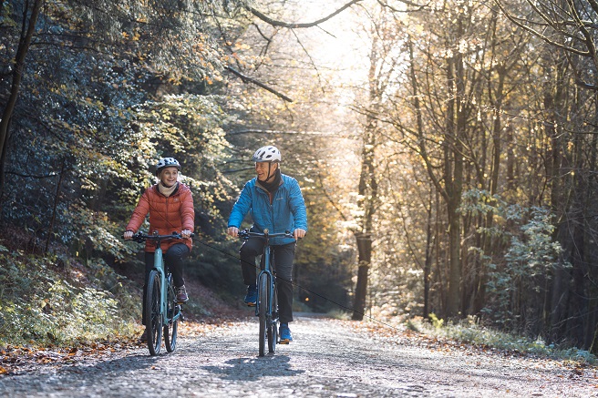
For mountain bikes and hybrids – our family friendly ‘Explorer’ routes follow forest and moorland tracks and country lanes, and show you amazing parts of the National Park that you can’t see by car. It's 'slow travel' for cyclists, with moorland and valley villages, shady forests, river crossings and coastal tracks all part of the package.
You might have to get off and push at times, but there’s always ice cream and cake and a country pub somewhere along the way. Explorer routes are circular, and the downloadable 'Explorer' route guides provide all the details you need to find your way. Follow the cycling instructions for a great day out!
NEW! Gribdale Gravel Explorer
- Distance: 11 km / 7miles | Grade: Easy/moderate | 300 m elevation
Starting point: Bike Base, Gribdale Terrace TS9 6HL
A taster gravel route around Roseberry Topping featuring quiet lanes, flowing forestry gravel and moorland tracks with steady climbs, all beneath the “Matterhorn of the north.” This short loop mixes some tarmac with a few gravel sections, good for riders new to off road cycling. Traversing under the hanging stone within Guisborough Forest and joining Percy Cross Rigg to Kildale before returning to Gribdale Gate.
The route can also be accessed via public transport using Kildale or Great Ayton station. Bike hire available from Bike Base.
Join Guy Kesteven, cycling journalist and ride the route in the video below:
NEW! Ingleby Horseshoe Gravel Explorer
- Distance: 35km / 22miles| Grade: Moderate | 620 m elevation
Starting point: Bike Base, Gribdale Terrace, TS9 6HL
From Bike Base, the route heads south through Easby and into Ingleby Greenhow before reaching the centrepiece of the ride: the Ingleby Horseshoe. This gravel section features long, flowing stretches of “champagne gravel” before emerging at Bank Foot.
The return leg passes back through Ingleby Greenhow and Kildale before joining National Cycle Network Route 168 on Percy Cross Rigg. From there, the route climbs into Guisborough Forest and follows the contours towards Roseberry common, sandwiched between Roseberry Topping and Little Roseberry, before the final descent down into Aireyholme Farm.
NEW ! Esk, Coast and Iron Gravel Explorer
- Distance: 60km / 37 miles| Grade: Hard | 1000m elevation
Starting point: Guisborough Town, TS14 6BX, parking available at Specialised Guisborough.
A gravel adventure through the historic “Land of Iron”, linking rugged coastline, rolling moorland and the industrial heritage of the North York Moors. The route follows quiet lanes, gravel tracks and flowing off road sections through woodland, farmland and former mining landscapes shaped by the region’s ironstone industry.
Passing through the old ironstone landscapes and down the Esk Valley, you’ll travel through the villages of Castleton, Commondale and Danby before reaching the coast at Skinningrove, home to the Land of Iron museum, joining the dismantled railway and riding back into Guisborough along the National Cycle Network 168.
A challenging journey from Guisborough through the Esk Valley and historic ironstone landscapes to the coast at Skinningrove, returning via the former railway and National Cycle Network Route 168.
NEW! Blakey and Fryup Gravel Explorer
- Distance: 50km / 31 miles | Grade: Hard | 1000m elevation
Starting point: Danby Lodge National Park Centre, YO21 2NB
Beginning in the heart of the Esk Valley at Danby Lodge National Park Centre, this route heads west along quiet country lanes and National Cycle Network Route 165 towards Kildale. A challenging climb onto the moorland escarpment leads to the centrepiece of the ride: Blakey Ridge, following the distinctive former railway line across the high moorland to The Lion Inn.
From here, the route joins sections of the Coast to Coast National Trail before descending back into the dramatic landscape of Fryup Dale and returning along the Esk Valley. Some pristine champagne gravel. Worth waiting for one of the clearer days given the exposure on the tops.
Also options to use the Esk Valley Railway to access the route or jump between stations using the train.
Moorland Meander
- 15 miles (25kms) Easy
Capturing the wild, open feel of the North York Moors – predominantly remains on ‘Top of the Rock’. The route heads out north starting on the Fort Trail then onto the Cleveland Way past High Paradise Farm. At the crossroads of Kepwick bank, the route turns east along champagne gravel through Little Moor atop the moorland plateau towards Arden Hall before heading south, returning back to the start, around 200m of climbing.
Rievaulx Raider
- 24 miles (38kms) Moderate
Inspired by Rievaulx Abbey and the area’s rich monastic history, enjoy the ebb and flow of pedalling within the River Rye watershed to Rievaulx. Start-off by following the Fort trail and then onto the Cleveland Way through Boltby Forest before turning down into Hawnby, one of the first villages in England to become a Dark Skies Friendly Community. The return involves climbing back up Nettle Dale through pastureland via Old Byland back to the start, around 600m of climbing.
Hambleton Horizon
- 30 miles (50kms) Moderate/Hard
Starting from Sutton Bank National Park Centre, this 50km gravel route is a rewarding journey along the former Drovers' Road, following the dramatic Cleveland Way escarpment to Osmotherley. The return leg winds through the lower edges of the hills via Kepwick and Boltby Forest, before a final blast past the famous “Finest View in England.”
With 865m of elevation gain over 50km, expect steady climbs, gentle descents and a true taste of North York Moors off-road cycling.
Kirkdale and Kirkbymoorside
- 12.8miles (20.5kms) Easy
Head off from Hutton le Hole on moorland, woodland and country lanes, through the small, quiet villages of Gillamoor and Fadmoor. There are stops at a peaceful old mill and the beautiful Saxon church at Kirkdale, both tucked away in idyllic surroundings, before the long pull up and around to the bustling market town of Kirkbymoorside. There are plenty of places to stop for refreshments here, after which it's a straightforward ride back into Hutton le Hole.
Littlebeck and Hawsker
- 12.3miles (19.7kms) Moderate
Explore the back roads, country lanes and woodland tracks between the valley hamlet of Littlebeck and the old ‘Cinder Track’ railway line between Scarborough and Whitby. There are sweeping views from Sneaton Moor, before an exhilarating freewheel down into Hawsker. The route runs through Sneaton (ice cream alert at Beacon Farm!), before dropping down into the woods and along the valley, back to Littlebeck. It’s a challenge in parts – there’s no shame in pushing up the hills or walking through the woods!
Dalby Forest Loop
- 14.9miles (23.9kms) Moderate
On this easy-to-follow circular bike ride you’ll experience iconic moorland and splendid views across the legendary Hole of Horcum, and discover two traditional villages and the delight of Dalby Forest. You should be prepared to walk up the short, steep roads to Lockton and Levisham, but otherwise it’s a ride for beginners, families and explorers alike.
Coast and Forest Circular
- 32.4miles (52.1kms) Moderate
For a great taster of the Moor to Sea Cycle Network head out on a thrilling 32½ -mile circular ride from the seaside town of Scarborough. Starting out along the ‘Cinder Track’, enjoy stops at the old station tea rooms at Cloughton and the secret woods and beach at Hayburn Wyke, before reaching Ravenscar headland and its magnificent views. Turn south for the forest sections through Harwood Dale and Langdale to the viewpoint at Highwood Brow. Then return east to Scarborough, travelling along the leg of the Moor to Sea route with perhaps the greatest variety – fine views, a beautiful valley and enchanting woodland, with forest roads that are broad, smooth and easy to ride.
Last updated: 28 Sep 2026