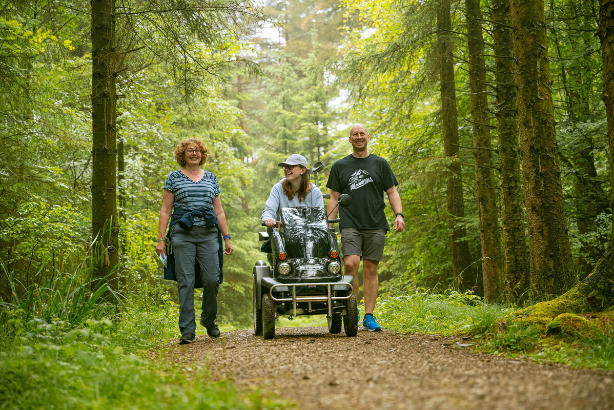
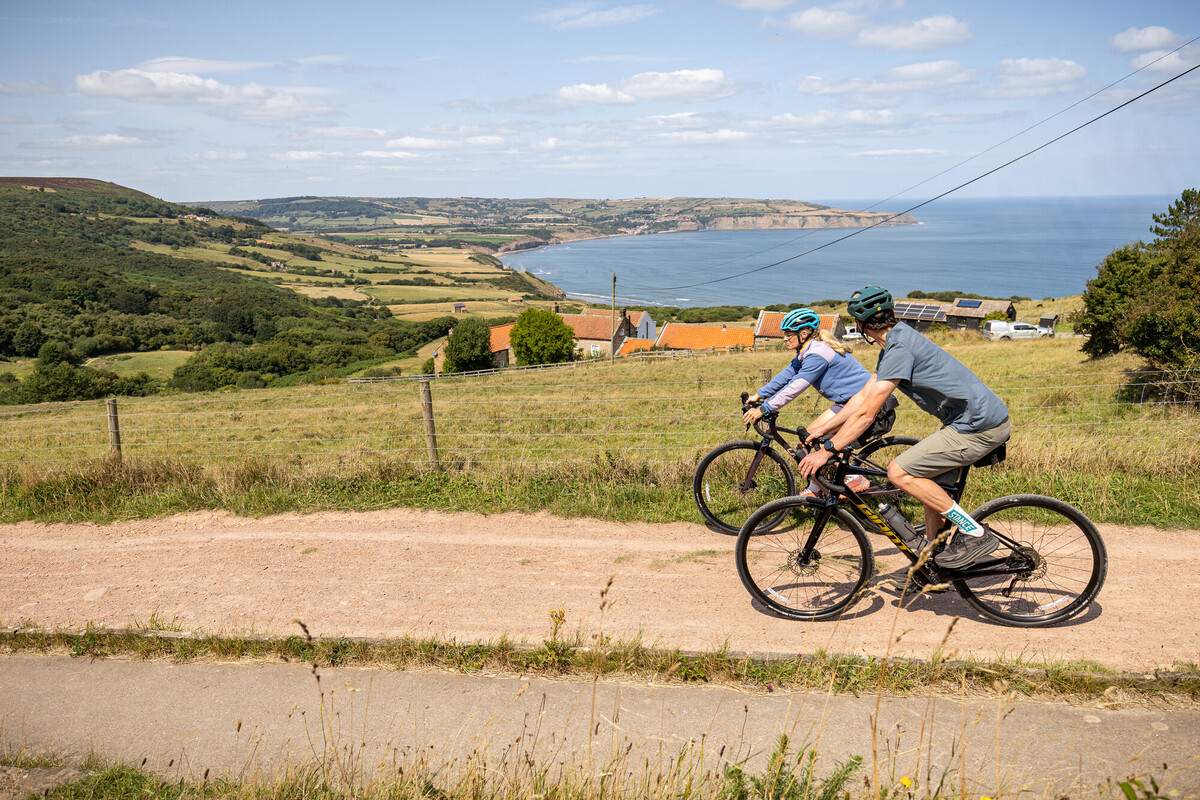
Active Travel is the term for journeys made by walking, wheeling, or cycling, which are powered in whole or in part by people. It encompasses a range of everyday travel, such as walking to school or work, cycling to the shops, or using mobility aids like wheelchairs. It offers the health benefits of more exercise and can reduce traffic and pollution.
Active Travel England (ATE), the Government’s executive agency for walking, wheeling and cycling, and are supporting National Park Authorities across England. The purpose of this funding is to help National Parks develop long-term, evidence-based Active Travel Plans that improve sustainable transport choices for residents and visitors.
The North York Moors National Park Authority was awarded funding from Active Travel England to improve walking, wheeling and cycling connections into and around the National Park. The focus of the North York Moors Active Travel Plan is to improve links with gateway towns to visitor attractions and destinations within the National Park. The North York Moors developed an LCWIP, a Local Cycling Walking and Infrastructure Plan, in line with the governments 6 step plan.
The North York Moors National Park Authority’s Local Cycling, Walking and Wheeling Infrastructure Plan (LCWIP) aims to create a comprehensive, National Park-wide strategy that makes active travel safer, more accessible, and more attractive for residents and visitors.
The key objectives are to:
- Support the preparation of Active Travel Plans tailored to the unique needs of rural and protected landscapes.
- Enable audits, research, engagement, and concept design to identify and prioritise key routes for improvement.
- Create a pipeline of investment-ready projects aligned with future national and local funding opportunities.
- Strengthen sustainable travel options that reduce carbon emissions, improve public health, and protect the natural environment.
The Active Travel Plan delivers these aims through:
- Audits of existing on- and off-road walking, cycling, and wheeling routes.
- Evidence gathering on visitor and resident travel patterns, rights of way, and accessibility.
- Stakeholder engagement with local councils, the highway authority, relevant organisations, and community transport groups.
- Network planning and prioritisation of key corridors for active travel.
- Concept designs for appropriate infrastructure such as quiet lanes, shared paths, greenways, mobility hubs, and other context-sensitive interventions across the National Park.
The map below illustrators the aspirational route corridors that will link people, place, communities and the National Park together.
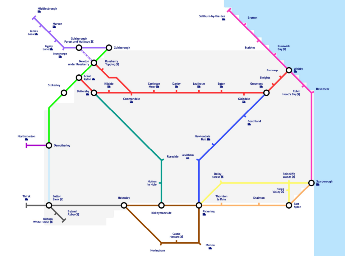
Priority Corridors identified***.
- Teesside → Guisborough & Roseberry Topping – close to urban populations, for utility and leisure trips.
- Thirsk → Helmsley (via Sutton Bank) – significant tourism access route via Sutton Bank.
- Esk Valley → stronger links to railway and targeted intervention around railway stations.
- Scarborough → Pickering (via Dalby Forest) – scenic, mostly traffic-free corridor.
To remain sensitive to the National Parks natural character, the plan focuses on an arrangement of sensitive interventions such as:
- Quiet lanes — low‑cost road treatments and speed reduction where appropriate.
- Shared‑use paths — segregated multi‑user paths alongside roads where traffic level require separation
- Greenways — upgraded unsurfaced bridleways and rights of way to provide traffic‑free routes
- Mobility hubs — modular hubs (at stations, gateways and destinations) offering bike hire, parking, e‑charging, wayfinding and local services.
- Other interventions — improved crossings, equestrian provisions, waymarking and targeted speed reductions.
To view the summary report see the North York Moors National Park Rural Local Cycling and Walking Infrastructure Plan.
Next Steps:
- Use the Active Travel Plan to support funding bids for implementation.
- Public consultation with the public as the routes reach design and delivery phase. We will work with communities as designs progress — local knowledge will shape where routes go and how they look.
- Progress priority corridors to detailed design as funding becomes available.
- Work with partners and landowners on permissions, phasing, and delivery.
***All of these routes require full feasibility, design and landowner permission, none of them have agreement to access land to develop the routes.