

Archaeological monuments on Fylingdales Moor have been added to Historic England’s 2026 Heritage at Risk Register, highlighting the lasting impact of last summer’s devastating wildfire and the challenge of safeguarding its archaeological heritage.
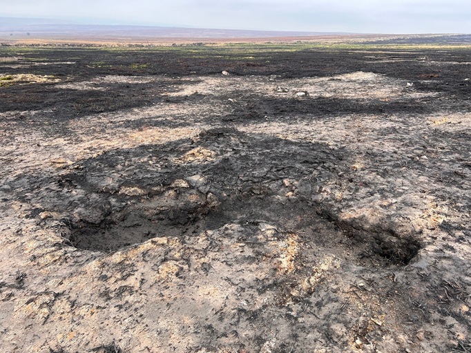
The fire, which burned across around 18 square kilometres of the National Park, exposed important archaeological features by stripping away vegetation and peat that had protected them for thousands of years. Many are now vulnerable to erosion from wind and rain, as well as from foot traffic and vehicle movements associated with restoration works.
The Heritage at Risk Register identifies historic sites that need attention and helps focus conservation advice, support and funding. For Fylingdales Moor, it brings further recognition of the scale of the damage and the work needed to safeguard its archaeological heritage.
But the fire also revealed previously unseen evidence of the area's past.
Discoveries include a previously unseen ring cairn (pictured) – one of several burial monuments from the early Bronze Age (Circa
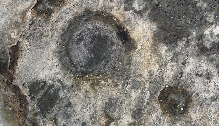
Alongside prehistoric finds, the fire also revealed more recent layers of the area’s story. During the Second World War, Fylingdales was part of a sophisticated bombing deception programme, including a ‘Starfish’ site, which used controlled fires to simulate bomb damage, alongside intentional ‘light leaks’ designed to make the area appear to be a target. Large craters, consistent with bombing from aircraft, sit alongside smaller artillery craters and foxholes created during military training exercises.
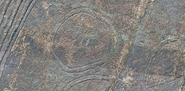
 High-resolution drone imagery and LiDAR (Light Detection and Ranging) technology is helping specialists capture these features in extraordinary detail, creating accurate records that can be used to assess their condition and plan conservation work.
Miles Johnson, Head of Historic Environment at the North York Moors National Park Authority, said:
“We’re grateful to Historic England for its support and expertise in helping to assess, record and protect the historic environment following the 2025 wildfire. The training and funding provided have been invaluable in building our capacity to use new technology to survey the affected landscape and understand the extent of the damage.
“While the fire and efforts to control its spread had a significant impact on important archaeological features, it also revealed previously unseen evidence of the area's past, giving us a greater understanding of how people have lived, worked and moved through this landscape over many thousands of years.
“Working with Historic England and other partners has helped the Authority to develop new approaches to record and conserve the landscape exposed in extraordinary detail at Fylingdales Moor. There is a real challenge to protect vulnerable archaeological sites, and an equal opportunity to absorb and share a more detailed story about this remarkable place.
“The process is creating new insights into the impacts that climate-driven wildfires will increasingly bring to upland landscapes, and we are determined to learn from them"
If you are interested in some of the work that is being done to restore and protect the monuments of Fylingdales Moor, you may like to read our blog about recent repair to a prehistoric barrow, or the emergency action carried out at the start of 2026 on John Cross Rigg.